About the Maps
Map I: Slave Revolts
Introduction to African Revolts map by Dr. Ife Williams with drumming by Saeed Abdul-Samad
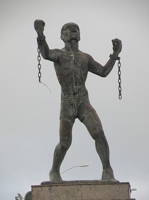
Context: In 1802 a visibly pregnant 30-year-old African woman named Solitude led Guadeloupean forces against French troops. After 18 days of rebellion, the revolutionaries set off gunpowder resulting in the deaths of more than 400 rebels and soldiers. Solitude was captured and executed after the birth of her unborn baby because the child was the property of her owner. She was executed the day after the birth of her child. Inspired by Solitude’s leadership, the guiding principle of the Guadeloupean revolt was that they would “live free or die.” The spirit of this belief permeated the more than 300 documented revolts initiated by enslaved Africans and their descendants from the onset of slavery into the twentieth century.
Presented here is a geopolitical representation of slave revolts by Africans and African descendants spanning roughly four and one-half centuries throughout Africa and the African This multimodal interactive map cites the chronology, frequency, and locations of revolts, illustrating that armed resistance took place from the onset of the European encounter including numerous attempts by victims to halt the trade in African people. The map markers incorporate descriptions, including persons involved and results, as displayed through video; audio; images; and text to contribute to the scholarship on resistance to enslavement. The digital revolt map can be used to consider a holistic approach to slavery including conditions; laws, particularly those on punishments; “thinking about revolting;” relationships within the enslaved community; and the role of international events that influenced the mobilization of African people.

Methods: The data for this map were obtained from various sources. At the outset, I utilized the foundational texts by Junius Rodriguez’s, Encyclopedia of Slave Revolts, (Greenwood, 2006) and Herbert Aptheker’s American Negro Slave Revolts, (International Publishers, 1983) which I then supplemented with archival sources from the Charles L. Blockson Afro-American Collection at Temple University in Philadelphia, Pennsylvania, the Schomburg Center for Research in Black Culture in Harlem, New York, and traditional bibliographical references.
Map markers are color-coded using red, black, green, blue, and yellow. Revolts on land use the liberation colors from civil rights leader Marcus Garvey (i.e. red, black, green, and yellow). Black represents African resistance up to and includes the 1600s, the green 1700s, the red 1800s, and the yellow 1900s. The blue markers are those revolts that took place at sea, noting that most of those revolts occurred around the coast of Africa.
The data for the ship revolts was accessioned by the Smithsonian Institute for their first international exhibit, “In Slavery’s Wake: Making Black Freedom in the World,” (2024-2026), in collaboration with Brazil, South Africa, Belgium, Senegal, and Liverpool.
Language: Initially, I used the term “enslavement of Africans and African descendants throughout the Diaspora;” however, to make this project accessible, the more searchable terms black “Black slave revolts” and the relevant geographical area are used.
Map II: Resistance
Although Black people were “freed” from enslavement around the globe beginning in 1804 (Haiti), the US in 1865, and up to 1888 (Brazil), Africans and their descendants merely transitioned from unpaid labor and savage treatment to depressed wages and second-class citizenship. Through limited political power, forced segregation, denial of quality education, employment, and housing opportunities, the race continued to suffer en masse. Map II begins with early organizing around labor that later led to the call for independence from colonialism, i.e., external control of territories, throughout Africa and the Caribbean. Everywhere Africans and African descendants resided, there was injustice, met with struggles for equality. Resistance took the form of strikes, marches, boycotts, sit-ins, armed self-defense, and revolts, as exemplified in this project.
Methods: This map aims to provide information on the various forms of Black resistance, spatially organized using geopolitical identifiers. It does not prove to be exhaustive, as there were numerous struggles. For example, over 100 riots occurred in the US after the assassination of Martin Luther King alone. I began collecting data from foundational texts on labor and civil rights movements, supplemented with information and images from the Amistad Archive in New Orleans, the Black Cultural Archive in Brixton, London, and the National Archive of the United Kingdom. As many photos taken after 1948 are copyrighted, more animations are used as illustrations.
Revolts Map
Resistance Map
Postscript:
I did the mapping out of love for my people and my heritage! I want to thank God and the Ancestors who shepherded this project along; my friends, family, students, graphic artists, and technicians that brought this work into fruition; all those folk who listened to me talk about “my map”over the years without little evidence of its existence, and special thanks to Scribe Video, Fine Editor muthi, and most of all Dr. Kalenda Eaton.
